MapZot.AI Launches Climate Intelligence to Map Flood Zones, Wetlands and Infrastructure Exposure at the Asset Level
New module links flood and wetland hazard layers with population, roads, critical facilities and property value to support risk assessment, mitigation planning and site selection
1st Oct 2026 - 2 min read
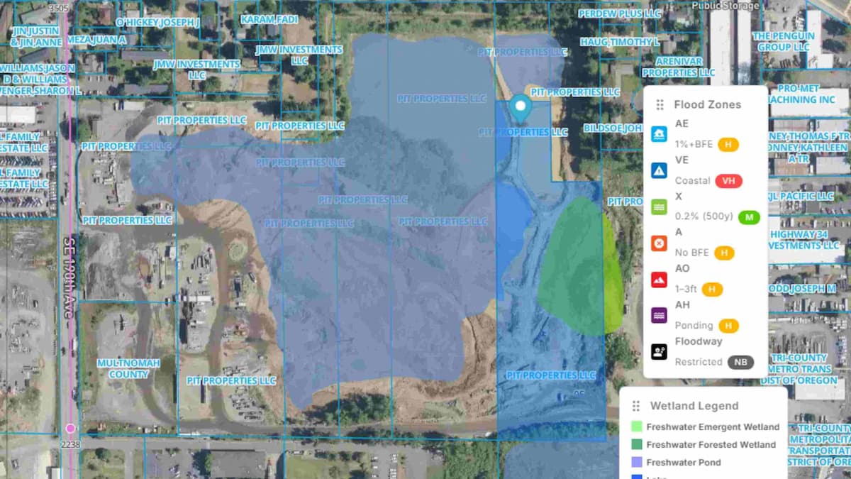
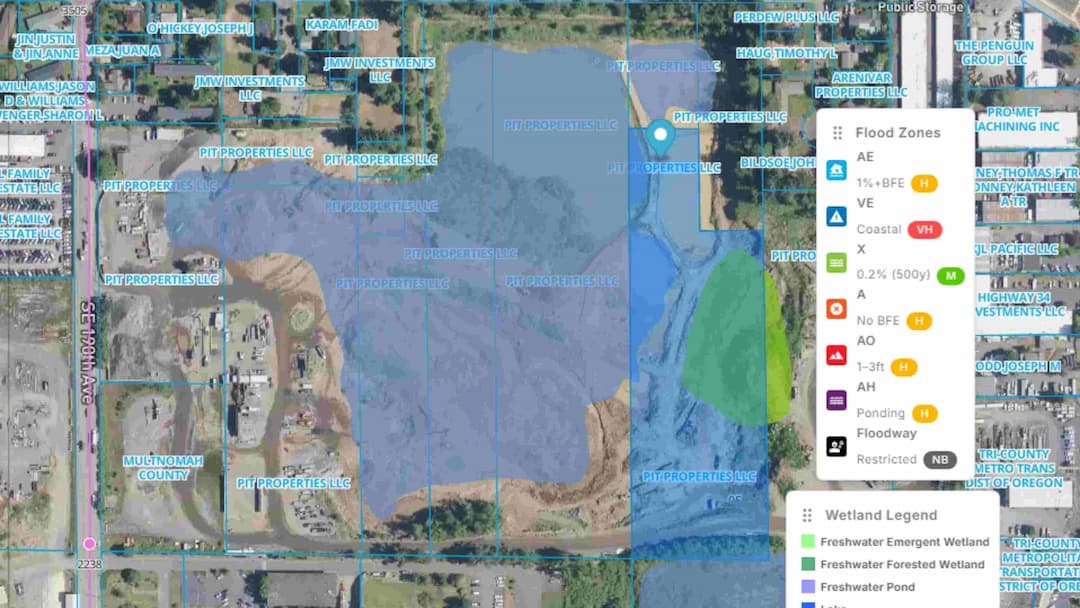
Atlanta,GA - 1st Oct 2026- MapZot.AI, an AI-powered location intelligence and market analytics platform, today launched Climate Intelligence, a module for mapping flood zones and wetlands and measuring what they put at risk. The platform connects climate hazards with population, infrastructure, mobility, property and operational data, then drills from regional exposure into asset-level consequence and mitigation.
Climate Intelligence is built for organizations that need to turn hazard maps into decisions: city and county planners, emergency managers, economic-development agencies, utilities, transportation agencies, commercial real estate firms, lenders, insurers and retail and restaurant site-selection teams.
What the module does
Climate Intelligence layers natural hazard data, including flood zones and [CONFIRM: wetlands, landslides and cyclones, as listed in the product interface], over people, buildings, roads, bridges and critical infrastructure. Users can start with a portfolio or regional view and move down to individual assets and corridors.
The module summarizes exposure in four headline measures:
- People potentially impacted: population within modeled hazard areas
- Asset value within modeled risk: the value of buildings and other assets in those areas
- Road miles exposed: mobility impact on the road network
- Critical facilities: hospitals and public assets within modeled hazard areas
In an example analysis shown in the product, the view for reports 1.24 million people potentially impacted, $18.6 billion in asset value within modeled risk, 1,840 road miles exposed and 286 critical facilities.
From exposure to mitigation
The workflow has two stages. In the first, users see what is at risk across six categories: population, residential and commercial assets, roads and bridges, critical infrastructure such as hospitals, power and telecom, commercial activity, and public services such as schools and civic assets. The platform also flags where a potential corridor closure could disrupt population access and services.
In the second, users plan and prioritize mitigation. The product surfaces options such as alternative routes, evacuation plans, drainage capacity gaps, backup power, telecom resilience and locations where new infrastructure investment may be needed. The aim is to show how combinations of measures, such as an alternate route, improved drainage and backup power, could strengthen continuity along a vulnerable corridor.
Why roads and mobility matter
Flood events affect economic activity largely through access: whether workers, customers, goods and emergency services can move. Treating flood zones and wetlands as only a land-use or insurance question can leave out the transportation and operational consequences. By pairing hazard layers with road, facility and property data, MapZot.AI is designed to let users test how a hazard could affect a specific corridor, facility or site, and what could be done about it.
"Flood risk is ultimately a question of access and continuity: can people reach jobs, hospitals and customers, and can businesses keep operating? Roads and mobility are one of the clearest signals of how a place functions economically, but they have often been analyzed separately from hazard data. Climate Intelligence is designed to put those views together so planners and operators can see consequence, not just a boundary on a map."
— Shobit Gupta, CEO, MapZot.AI
Use cases
Municipal and county planning: identify exposed neighborhoods, road segments and public facilities for capital planning and evacuation routing
Economic development: assess flood and wetland constraints on industrial sites, corridors and growth areas
Commercial real estate and lending: compare asset-level exposure across a portfolio
Retail, restaurant and QSR site selection: screen candidate locations for hazard exposure and access risk before committing capital
Utilities and telecom: locate resilience gaps and backup-power needs
Transportation and smart-city teams: identify bridges and corridors where closure would cause the greatest service disruption
About MapZot.AI
MapZot.AI is an AI-powered location intelligence and market analytics platform that helps organizations make decisions involving locations, markets, traffic, competition and economic development. The platform brings location-based data and analytical capabilities together to help businesses and organizations evaluate markets, properties, commercial corridors and changing patterns of activity. Its applications span industries including retail, restaurants and QSRs, coffee, commercial real estate, advertising and OOH, automotive, mobility, economic development and other location-driven sectors.
MEDIA CONTACT
Khadija P.
Sr. Associate Digital Marketing
MapZot.AI
khadija.patanwala@mapzot.com
www.mapzot.ai