Macro → Asset-Level Intelligence
See the macro impact. Then know exactly which assets fail first.
MapZot.AI connects climate hazards with population, infrastructure, mobility, property and operational data—then drills from regional exposure into asset-level consequence and mitigation.
People Potentially Impacted
1.24M
Macro exposure
Asset Value Within Modeled Risk
$18.6B
Portfolio view
Road Miles Exposed
1,840
Mobility impact
Critical Facilities
286
Hospitals + public assets
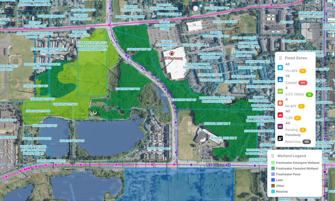
Macro Exposure — Flood / Wetlands / Infrastructure
REGIONAL IMPACT LENS
Prioritize the places where climate exposure becomes economic and service disruption.
Macro Impacts
Quantify consequence before drilling into assets.
Combine hazard intensity with people, residences, property value, roads, traffic, hospitals, power, telecom and public infrastructure to identify the highest-consequence geographies.
Population & communities
Who is exposed and where vulnerable groups concentrate
Infrastructure & mobility
Roads, bridges, traffic, hospitals and emergency access
Economic exposure
Property, commercial assets and operational value at risk
Critical dependencies
Power, telecom, water and service-continuity bottlenecks
MACRO PRIORITY → ASSET CONSEQUENCE
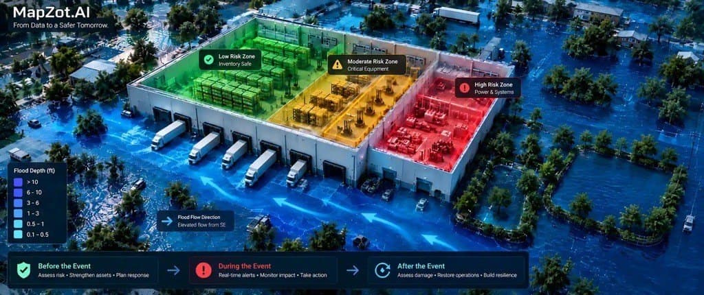
Asset-Level RiskFlood · Access · Power · Telecom
ASSET CONSEQUENCE
Move from “where is the hazard?” to “what fails, when, and what should we do?”
HIGH RISK ASSET
Distribution Center #142
Miami, Florida · Representative asset workflow
Flood depth at asset4.2 ft
Access reliability31%
Power continuity54%
Telecom continuity68%
POTENTIAL IMPACT
Operations
Dock access disrupted; inbound/outbound movement constrained
Financial
Inventory + downtime exposure requires escalation
Dependency
Power and road access create compounding failure risk
Mitigation
Prioritize access hardening, drainage and backup power
Preventive
01
Audit. Score. Mitigate.
Portfolio audit
Risk scoring
Mitigation priorities
Real-Time
02
Trigger. Predict. Alert.
Alarms & triggers
Potential impact
Alerts & actions
Post-Impact
03
Assess. Prioritize. Recover.
Impact analysis
Damage assessment
Recovery priority
Decision Intelligence
One risk engine—from national exposure to the individual asset, dependency and mitigation action.
FloodingExtreme RainStormsWildfireHeat